| |
|
Atlas-country

|
Democratic Republic of the Congo
|
|
|
|
|
|
|
|
République Démocratique du Congo
Repubilika ya Kongo Demokratiki
Republíki ya Kongó Demokratíki
Jamhuri ya Kidemokrasia ya Kongo
Ditunga dia Kongu wa Mungalaata
|
|
|
|
| Français
|
République Démocratique du Congo
La République démocratique du Congo est un vaste pays d’Afrique centrale qui s’étend de l’océan Atlantique au plateau de l’est et correspond à la majeure partie du bassin du fleuve Congo. Le nord du pays est un des plus grand domaine de forêt équatoriale au monde, l’est du pays borde le grand rift est-africain, domaine des montagnes, des collines, des grands lacs mais aussi des volcans. Le sud et le centre, domaine des savanes arborées, forment un haut plateau riche en minerai. À l’extrême ouest, une quarantaine de kilomètres au nord de l'embouchure du fleuve Congo s’étale une côte sur l’océan Atlantique. Le pays partage ses frontières avec l’enclave de Cabinda (Angola) et la République du Congo à l’ouest, la République centrafricaine et le Soudan du Sud au nord, l’Ouganda, le Rwanda, le Burundi et la Tanzanie à l’est, la Zambie et l’Angola au sud.
|
| Kikongo
|
Repubilika ya Kongo ya Dimokalasi
Repubilika ya Kongo ya Dimokalasi to Kongo-Kinsasa kele nsi na Afelika ya Kati. Bansi ya pembeni na yandi kele Repubilika ya Kongo, Repubilika ya Afelika ya Kati, Sudan, Uganda, Rwanda, Burundi, Zambia ye Angola. Kongo-Kinsasa kele leta ya tatu na munene ya Afelika.
|
| Lingala
|
Republíki ya Kongó Demokratíki
Republíki ya Kongó Demokratíki ezalí esé ya Afríka ya Mambénga, ezwamí na ndelo ya ye ya mwa sánzá ya motóbá mikɔlɔ 30 1960, ekólo ya makokí, lipanda, bonsɔ́mí, ekanganí mpé ekabwaní tɛ́, ya bato, ya bokonzi boutí na bato mpé eponi eyamba yɔ̂kɔ tɛ́.
|
| KiSwahili
|
Jamhuri ya Kidemokrasia ya Kongo
Jamhuri ya Kidemokrasia ya Kongo (au Kongo-Kinshasa) ni nchi kubwa ya tatu Afrika iliyoko Afrika ya Kati. Imepakana na ► Jamhuri ya Kongo, ► Jamhuri ya Afrika ya Kati, ► Sudan, ► Uganda, ► Rwanda, ► Burundi, ► Tanzania, ► Zambia na ► Angola. Ina sehemu ndogo iliyopakana na pwani na Bahari ya Atlantiki. Sehemu hii inatenganisha eneo la Angola la Cabinda kutoka maeneo mengine ya Jamhuri ya Angola.
|
| Tshiluba
|
Ditunga dia Kongu wa Mungalaata}
|
| English
|
Democratic Republic of the Congo - Democratic Republic of the Congo
The Democratic Republic of the Congo (often referred as Congo-Kinshasa and formerly as Zaire), is the third largest country, by area, on the African continent. Though it is located in the Central African UN subregion, the nation is economically and regionally affiliated with Southern Africa as a member of the Southern African Development Community (SADC). It borders the ► Central African Republic and ► Sudan on the north, ► Uganda, ► Rwanda, ► Burundi, and ► Tanzania on the east, ► Zambia and ► Angola on the south, and the ► Republic of the Congo on the west. The country enjoys access to the sea through a narrow forty kilometre stretch, following the Congo river into the Gulf of Guinea.
|
|
|
|
| Short name
|
Democratic Republic of the Congo
|
| Official name
|
Democratic Republic of the Congo
|
| Status
|
Independent country since 1960
|
| Location
|
Central Africa
|
| Capital
|
Kinshasa
Kinsasa
Kinsásá
|
| Population
|
91,994,000 inhabitants
|
| Area
|
2,344,858 square kilometres (905,355 sq mi)
|
| Major languages
|
French (official), KiKongo, Lingala, Tshiluba and Swahili.
|
| Major religions
|
Christianity
|
| More information
|
Democratic Republic of the Congo, Geography of the Democratic Republic of the Congo, History of the Democratic Republic of the Congo and Politics of the Democratic Republic of the Congo
|
| More images
|
Democratic Republic of the Congo - Democratic Republic of the Congo (Category).
|
|


 Bas-Congo
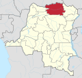 Bas-Uele
 Haut-Katanga
 Haut-Lomami
 Haut-Uele
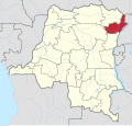 Ituri
Ituri Kasaï-Central
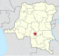 Kasaï-Oriental
 Kasaï
Kasaï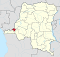 Kinshasa
 Kwango
 Kwilu
Kwilu Lomami
 Lualaba
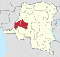 Mai-Ndombe
 Maniema
 Mongala
 Nord-Kivu & Ituri
 Nord-Kivu
 Nord-Ubangi
 Sankuru
 Sud-Kivu
 Sud-Ubangi
 Tanganyika
 Tshopo
 Tshuapa
 Équateur
_-_Bas-Congo.svg)
_-_Bas-Uele.svg)
_-_Haut-Katanga.svg)
_-_Haut-Lomami.svg)
_-_Haut-Uele.svg)
_-_Ituri.svg)
_-_Kasa%C3%AF-Central.svg)
_-_Kasa%C3%AF-Oriental.svg)
_-_Kasa%C3%AF.svg)
_-_Kinshasa.svg)
_-_Kwango.svg)
_-_Kwilu.svg)
_-_Lomami.svg)
_-_Lualaba.svg)
_-_Mai-Ndombe.svg)
_-_Maniema.svg)
_-_Mongala.svg)
_-_Nord-Kivu_%26_Ituri.svg)
_-_Nord-Kivu.svg)
_-_Nord-Ubangi.svg)
_-_Sankuru.svg)
_-_Sud-Kivu.svg)
_-_Sud-Ubangi.svg)
_-_Tanganyika.svg)
_-_Tshopo.svg)
_-_Tshuapa.svg)
_-_%C3%89quateur.svg)


