File:Allier et provinces.svg
Jump to navigation
Jump to search

Size of this PNG preview of this SVG file: 748 × 600 pixels. Other resolutions: 299 × 240 pixels | 599 × 480 pixels | 958 × 768 pixels | 1,277 × 1,024 pixels | 2,554 × 2,048 pixels | 1,111 × 891 pixels.
Original file (SVG file, nominally 1,111 × 891 pixels, file size: 306 KB)
Captions
Captions
Add a one-line explanation of what this file represents
Summary
[edit]
| Description |
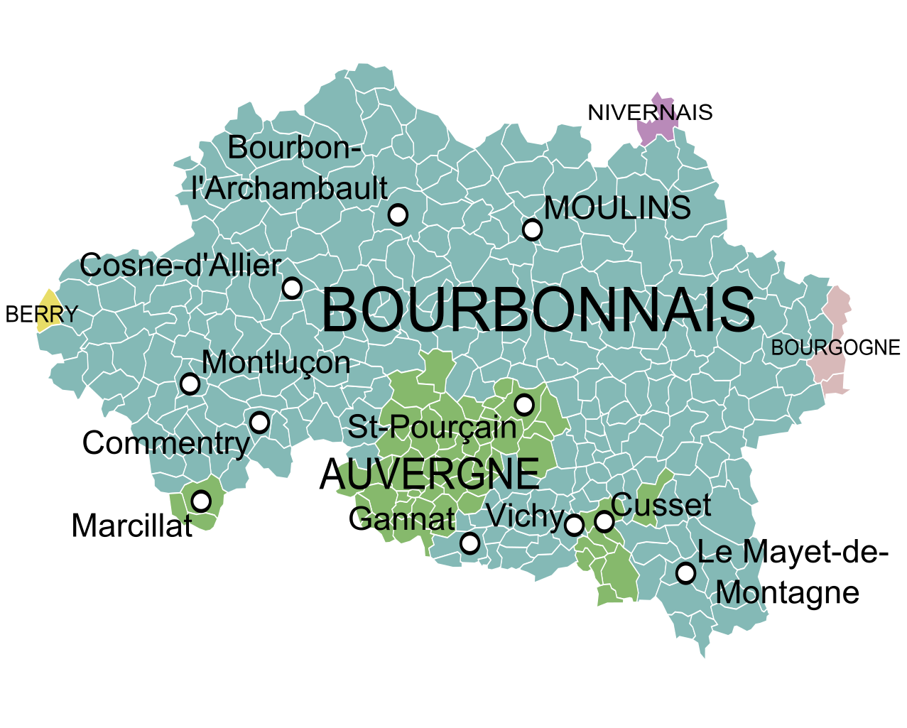
English: Map showing the French department of Allier and the former provinces that existed before 1790. Français : Carte de l'Allier montrant les provinces existant avant 1790. |
| Date | |
| Source |
Gouvernemens généraux de la Marche, du Limousin, et de l'Auvergne et Gouvernements généraux du Berry, du Nivernois, et du Bourbonois, Robert de Vaugondy, 1753. Derivative works of this file: Blank Map of Allier Department, France, with Communes.svg by Poulpy |
| Author | Oie blanche |
Licensing
[edit]
I, the copyright holder of this work, hereby publish it under the following license:
This file is licensed under the Creative Commons Attribution-Share Alike 3.0 Unported license.
- You are free:
- to share – to copy, distribute and transmit the work
- to remix – to adapt the work
- Under the following conditions:
- attribution – You must give appropriate credit, provide a link to the license, and indicate if changes were made. You may do so in any reasonable manner, but not in any way that suggests the licensor endorses you or your use.
- share alike – If you remix, transform, or build upon the material, you must distribute your contributions under the same or compatible license as the original.
File history
Click on a date/time to view the file as it appeared at that time.
| Date/Time | Thumbnail | Dimensions | User | Comment | |
|---|---|---|---|---|---|
| current | 09:43, 9 December 2018 | | 1,111 × 891 (306 KB) | Oie blanche (talk | contribs) | Position de Vichy. |
| 05:14, 16 January 2014 |  | 1,111 × 891 (308 KB) | Oie blanche (talk | contribs) | User created page with UploadWizard |
You cannot overwrite this file.
File usage on Commons
There are no pages that use this file.
File usage on other wikis
The following other wikis use this file:
- Usage on el.wikipedia.org
- Usage on fr.wikipedia.org
- Usage on ja.wikipedia.org